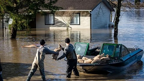
Ottawa’s long-promised national flood risk database for homebuyers is behind schedule, leaving Canadians without a fully functional tool to check whether properties are exposed to flooding risks, according to the federal environment watchdog.The Commissioner of the Environment says the public-facing system, intended to allow users to enter an address and view flood exposure data, was supposed to be launched by December 31 but remains incomplete, with key features still unavailable.Jerry DeMarco, Canada’s environment commissioner, said the idea behind the platform is to help Canadians make informed decisions before purchasing property, but warned its usefulness depends heavily on how much risk information is included.“Having a public portal where people considering buying a house would be able to look up their address… would be very helpful,” DeMarco said. “But if it doesn’t have the capability of factoring in climate change scenarios, then it’s of limited utility.”Blacklock's Reporter says a prototype of the system has been launched, but DeMarco noted that core functionality allowing users to input an address is still disabled and marked as “coming soon,” with no explanation provided for the delay.The concerns are outlined in a broader report, Flood Hazard Mapping, which criticizes federal agencies for slow progress in producing updated flood maps used by municipalities and planners to assess risk in high-exposure areas.The report says many existing maps are outdated or incomplete, limiting their usefulness for decision-making in urban development and infrastructure planning..“Many maps had not yet been completed and most of the existing flood hazard information is not practical or actionable for users,” the report states. “Without them, public safety and infrastructure are at risk.”DeMarco estimates flooding-related disaster relief costs taxpayers roughly $230 million annually. He said delays in producing accessible mapping tools undermine efforts to reduce long-term risk.“The flood zone map serves to inform citizens, property developers and those responsible for infrastructure planning,” he said, adding that federal managers have been slow to deliver usable data to communities.The Department of Public Safety had previously said the database would be a foundational step toward a national flood insurance system. A 2025 departmental report noted that most Canadians are unaware of the flood risk associated with their homes.Earlier federal analysis has also pointed to the need for broader insurance reform. A 2022 task force report, Adapting To Rising Flood Risk, proposed a mandatory $900 annual insurance program for homeowners in high-risk flood zones, arguing that current disaster relief systems effectively shift costs onto taxpayers.The report described Canada’s existing approach as a “market failure,” noting that high-risk homeowners either rely on publicly funded disaster assistance or carry unmanaged financial exposure.According to the Insurance Bureau of Canada, roughly 10% of residential properties in Canada face some level of overland flood risk. A national flood strategy has been under federal review since 2017, but has yet to be fully implemented.